Cemeteries and Burial Grounds
Secret Symbols of Cemeteries 2020 Courtney Henderson, Old Farmers Almanac
NH Chronicle - NH Old Graveyards Association November 1, 2019
Walk through History 10/11/2018 The Hippo,
NH's overgrown cemeteries stand as sentinels to history 04/22/2016 Dave Anderson, Union Leader
Misleading Gravestone Inscriptions NHCA March 2014 Bill & Carol Vose
Number of Cremations vs Full Burials Catholic Cemetery January 2002
Coffin and a Box Recently we were asked about a term used in Town Reports from the 1800s where the Town paid for the burial of individuals then living at the Town Farm. Some of the payments listed were for "a coffin and a box". Since burial vaults were not used at that time, especially for burials paid for by the Town, what was the "box"? In our research we found an 1840 will that refers to a coffin and a box, the box being the shipping container to transport a body to its final resting place. Quite interesting. If you have a different idea of what the box was, let us know!
Gilmanton Records
Burial Grounds and Cemeteries in Gilmanton were initially privately established to serve a person, family, group or area. None were initially created by the Town to serve the community. As a result, there are no records for most of the sites and some records for a few.
When Marion and Phil McIntyre moved to Gilmanton with their family in 1957, Marion developed a great curiosity about the cemeteries. She spoke with many whose families had been here for generations and they were generous with their knowledge. One such person was Lois Brown. Marion spent many quiet hours with Lois who fanned the flames of Marion's curiosity about Gilmanton's history into a life-long passion.
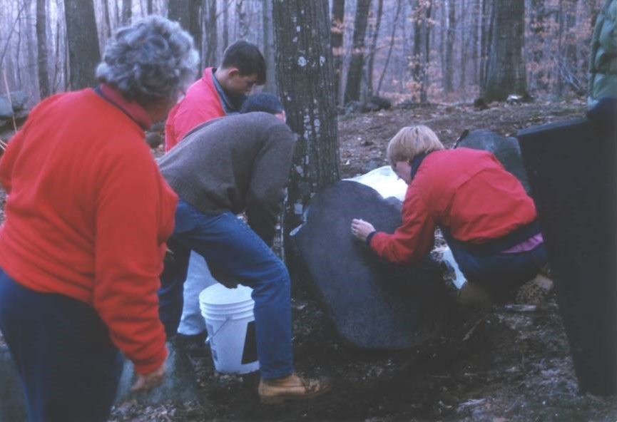 Marion went to every grave in every burial ground she could locate. She recorded all of the information she found. She followed research trails across the state. People began to contact her about forgotten sites and lost graves and she gathered quite a following of helpers who found lost sites, raked out debris and found fallen stones. Marion was elected as a Trustee of Cemeteries in 1989, a position she held until her retirement in 2012.
 The records below are available through the cooperation of Marion and the Gilmanton Cemetery Trustees. Additional information is gratefully accepted. See our Resources page for other options and visit the Gilmanton Cemetery Trustees page for assistance.
Early Gilmanton & Regional Cemeteries NH State History
The American Legion Auxiliary developed a keystone project to identify and catalog the burial site for all Veterans interred in Gilmanton. A description of their project, the current list of locations and a form to submit additional information are listed below:
Veterans at Rest – Keystone Project
Veterans at Rest Data Form
Veterans Buried In Gilmanton Feb. '23 (alphabetically)
Veterans Buried In Gilmanton Feb, '21 (by cemetery)
Gilmanton Cemeteries and Burial Grounds
Pine Grove Cemetery is private & not maintained by town Daily Sun 06/02/2020
Gilmanton has allowed Pine Grove Cemetery to remain unkept Daily Sun 05/25/2020
Gilmanton cemeteries damaged in rash of disturbances 10/08/2019 Daily Sun
Cemetery Fund Donations Gratefully Accepted
Cemeteries Around Lake Winnipesaukee, Glenn A. Knoblock An Images of America Publication Chapter Ten-The Gilmantons
The maintenance care fund for Town-owned/managed sites does not currently produce sufficient annual income for their maintenance. Some additional funding is currently provided by the taxpayers of the Town of Gilmanton. Donations to the care fund of any amount are very much appreciated. Donations
Town Map-All Cemeteries/Burial Grounds/Memorial Sites
General Details for Individual Cemeteries/Burial Grounds/Memorial Sites
MORE INFORMATION ON GILMANTON SITES COMING!
CEMETERIES LISTED BELOW
CEMETERIES LISTED BELOW
Beech Grove Cemetery
Map Site #17 - 563 Province Road - Public Cemetery - See All Sites DetailsOwned/Managed: Town of Gilmanton/Gilmanton Cemetery Trustees
Gilmanton cemeteries damaged in rash of disturbances 10/08/2019 Daily Sun
Current Lots For Sale Plan 07Aug2022
Names - Burials, Lot Owners, Otherwise referenced 14Mar2023
1972 Plot Plan
Besse Cemetery
Map Site #34 - Hall's Hill Road - Public Cemetery - See All Sites DetailsOwned/Managed: Town of Gilmanton/Gilmanton Cemetery Trustees
Buzzell Cemetery
Map Site #4 - 121 Shellcamp Road - Public Cemetery - See All Sites DetailsOwned/Managed: Town of Gilmanton/Gilmanton Cemetery Trustees
1991 Buzzell Cemetery New Section Layout
1989 Buzzell Cemetery Old Section Layout
1988 Buzzell Cemetery Survey New and Old Sections
Friends Cemetery
Map Site #8 - State Route 140 - Public Cemetery - See All Sites DetailsOwned/Managed: Town of Gilmanton/Gilmanton Cemetery Trustees
Gilmanton cemeteries damaged in rash of disturbances 10/08/2019 Daily Sun
Quakers Deed Cemetery to Town 1992
Richard F. Varney Bequest - Land and Cemetery and Land Trust Fund 1969
Hillside Cemetery
Map Site #11 - 9 Edgerly Road - Public Cemetery - See All Sites DetailsOwned/Managed: Town of Gilmanton/Gilmanton Cemetery Trustees
1949 Cemetery Map
Pine Grove Cemetery - Privately Owned & Managed
Map Site #16 - 729 Stage Road - Private Cemetery - See All Sites DetailsOwned/Managed: Pine Grove Cemetery Association
1893 Cemetery Map
Early Pine Grove Pictures Pic1 Pic2 Pic4
Shannon, Ephraim - Stone
Pine Grove Cemetery is private & not maintained by town Laconia Daily Sun
Gilmanton has allowed Pine Grove Cemetery to remain unkept Laconia Daily Sun
Smith Meeting House Cemetery - Privately Owned & Managed
Map Site #18 - 451 Meeting House Road - Private Cemetery - See All Sites DetailsOwned/Managed: Smith Meeting House Association
Brief History, 2022
Brief History, Edward J. Maher, 1969
Records of the Congregational Church 1774-1819
Baptisms performed by the Revd. Isaac Smith 1775-1819
Ecclesiastical History re: Lieut Parker Morgan
Current Burial Layout
1935 Cemetery Map
2019 Boundary Plan
2005-2021 Burials
1990 Record of existing stones, Marion McIntyre
1911 Death Records
BURIAL GROUNDS and PRIVATE MEMORIALS
LISTED BELOW
LISTED BELOW
Ayers Crypt
Map Site #43 - - Private Burial Ground - See All Sites DetailsOwned/Managed: Descendants/Gilmanton Cemetery Trustees
Profile
2022 Pictures
2003 Pictures
1994 Pictures
Brown Memorial
Map Site #47 - Meadow Pond Road - Private Memorial Site - See All Sites DetailsOwned/Managed: Descendants/Descendants
Raymond Brown - 16Jul1935 - 07Sep2018
Burdett Memorial
Map Site #43 - Crystal Lake Road - Private Memorial Site - See All Sites DetailsOwned/Managed: Descendants/Descendants
Dean Upton Burdett Aug 29, 1918-1976
Robert Munsey Burdett Aug 26, 1920-Sep 28, 1993
John Damon Burdett Aug 26, 1920-Nov 23, 2002
Phyllis Burdett Parton May 17, 1923-Aug 8, 1980
Carr Burial Ground
Map Site #1 - Upper City Road - Private Burial Ground - See All Sites DetailsOwned/Managed: Descendants/Gilmanton Cemetery Trustees
Clough Burial Ground
Map Site #35 - Old Stage Road - Private Burial Ground - See All Sites DetailsOwned/Managed: Descendants/Gilmanton Cemetery Trustees
Copp Burial Ground
Map Site #7 - Province Road - Private Burial Ground - See All Sites DetailsOwned/Managed: Descendants/Gilmanton Cemetery Trustees
Durrell Burial Ground
Map Site #40 - Durrell Mountain Road - Private Burial Ground - See All Sites DetailsOwned/Managed: Descendants/Descendants
Edgerly (1) Burial Ground
Map Site #26 - Old Stage Road - Private Burial Ground - See All Sites DetailsOwned/Managed: Descendants/Gilmanton Cemetery Trustees
Edgerly (2) Burial Ground
Map Site #27 - Hatch Road - Private Burial Ground - See All Sites DetailsOwned/Managed: Descendants/Gilmanton Cemetery Trustees
Emerson Burial Ground
Map Site #30 - Geddes Road - Private Burial Ground - See All Sites DetailsOwned/Managed: Descendants/Gilmanton Cemetery Trustees
Foss Burial Ground
Map Site #28 - Pine Hill Road - Private Burial Ground - See All Sites DetailsOwned/Managed: Descendants/Gilmanton Cemetery Trustees
Foster Burial Ground
Map Site #38 - Allens Mill Road - Private Burial Ground - See All Sites DetailsOwned/Managed: Descendants/Descendants
French Burial Ground
Map Site #20 - French Road - Private Burial Ground - See All Sites DetailsOwned/Managed: Descendants/Gilmanton Cemetery Trustees
Gilman Burial Ground
Map Site #45 - Province Road - Private Burial Ground - See All Sites DetailsOwned/Managed: Descendants/Descendants
In 1773, the burying yard of the Gilman family was begun near where Calvin Howe later lived and carried on a mercantile business. Few had been buried there, however, and the remains of many have been removed to more permanent ground when the cemetery was closed to facilitate the widening of the highway. Located at the top of Frisky Hill. Most were moved to Smith Meeting House Cemetery.
Guinea Ridge Burial Ground
Map Site #3 - Guinea Ridge Road - Private Burial Ground - See All Sites DetailsOwned/Managed: Descendants/Gilmanton Cemetery Trustees
Hatch Road Burial Ground
Map Site #31 - Hatch Road - Private Burial Ground - See All Sites DetailsOwned/Managed: Descendants/Gilmanton Cemetery Trustees
Hatie Smith Road Burial Ground
Map Site #33 - Middle Route - Private Burial Ground - See All Sites DetailsOwned/Managed: Descendants/Gilmanton Cemetery Trustees
Hilliard Burial Ground
Map Site #21 - Griffin Road - Private Burial Ground - See All Sites DetailsOwned/Managed: Descendants/Gilmanton Cemetery Trustees
Levi Hutchinson Burial Ground
Map Site #13 - Middle Route - Private Burial Ground - See All Sites DetailsOwned/Managed: Descendants/Gilmanton Cemetery Trustees
Indian Burial Ground
Map Site #41 - State Route 129 - Private Burial Ground - See All Sites DetailsOwned/Managed: Descendants/Descendants
Kimball Memorial
Map Site #42 - Meadow Pond Road - Private Memorial Site - See All Sites DetailsOwned/Managed: Descendants/Descendants
David W. Kimball, Sr.
May 21, 1949-July 20, 2015
Leavitt Road Burial Ground
Map Site #15 - Leavitt Road - Private Burial Ground - See All Sites DetailsOwned/Managed: Descendants/Gilmanton Cemetery Trustees
Lougee Burial Ground
Map Site #25 - Crystal Lake Road - Private Burial Ground - See All Sites DetailsOwned/Managed: Descendants/Gilmanton Cemetery Trustees
Merrill Burial Ground
Map Site #19 - Pancake Hill Road - Private Burial Ground - See All Sites DetailsOwned/Managed: Descendants/Gilmanton Cemetery Trustees
Mudgett Burial Ground
Map Site #23 - Loon Pond Road - Private Burial Ground - See All Sites DetailsOwned/Managed: Descendants/Gilmanton Cemetery Trustees
Osgood Burial Ground
Map Site #22 - Loon Pond Road - Private Burial Ground - See All Sites DetailsOwned/Managed: Descendants/Gilmanton Cemetery Trustees
Page Burial Ground
Map Site #22 - Middle Route - Private Burial Ground - See All Sites DetailsOwned/Managed: Descendants/Gilmanton Cemetery Trustees
Parsons Burial Ground
Map Site #29 -Province Road - Private Burial Ground - See All Sites DetailsOwned/Managed: Descendants/Gilmanton Cemetery Trustees
Plummer Burial Ground
Map Site #12 - Sawyer Lake Road - Private Burial Ground - See All Sites DetailsOwned/Managed: Descendants/Gilmanton Cemetery Trustees
Sanborn Burial Ground
Map Site #14 - Middle Route - Private Burial Ground - See All Sites DetailsOwned/Managed: Descendants/Gilmanton Cemetery Trustees
Sawyer Lake Burial Ground
Map Site #32 - Sawyer Lake Road - Private Burial Ground - See All Sites DetailsOwned/Managed: Descendants/Gilmanton Cemetery Trustees
Sleeper Burial Ground
Map Site #9 - Old Stage Road - Private Burial Ground - See All Sites DetailsOwned/Managed: Descendants/Gilmanton Cemetery Trustees
Tibbetts Burial Ground
Map Site #10 - State Route 140 - Private Burial Ground - See All Sites DetailsOwned/Managed: Descendants/Gilmanton Cemetery Trustees
2023 Stones to be repaired
Town Farm Burial Ground
Map Site #44 - Town Farm Road - Private Burial Ground - See All Sites DetailsOwned/Managed: Descendants/Descendants
From its earliest settlements New Hampshire has struggled with issues surrounding the treatment of its poor. The early Northeastern colonies followed the lead of England's 1601 Poor Law, which imposed compulsory taxes for maintenance of the poor but made no distinction between the "vagrant, vicious poor" and the helpless, and honest poor. This confusion persisted for generations and led directly to establishment in most of the state's towns of almshouses, poor farms, and, later, county institutions which would collectively come to form a dark chapter in New Hampshire history. Poor Houses and Town Farms: The Hard Row for Paupers-Steve Taylor
What if the poor were sent to work on town-owned farms? They were and it wasn't pretty 07/23/2016 Concord Monitor
Unity Almshouse Sara Poisson 2009
Silent Voices From the Past Sara Poisson 2010
Gilmanton's Poor Farms
First Gilmanton Poor Farm: Until 1830 Gilmanton "auctioned out" paupers. In 1830 a farm on Meetinghouse Road (Tax Lot 419-028-000-000) was purchased from Lewis W. Gilman (grandson of Jotham Gilman). Paupers were sent to the farm to work as able. In 1845 Daniel Ayers was the owner and appointed "overseer". On October 22, 1847, the dwelling at the town farm burned.
Second Gilmanton Town Farm: A special town meeting was held. It was voted to sell the Ayers property and buy the Moses Stevens farm on Town Farm Road ( Tax Lot 420-073-000-000) for $3,000. In 1870 this second town farm was sold as it was too expensive to maintain for the small number of paupers. They were then boarded out. An area on this Poor Farm has been identified as a burial ground. No records of burials exist.
Town Histories re: Poor Farms
Town Report Excerpts
Weed Burial Ground
Map Site #39 - Allens Mill Road - Private Burial Ground - See All Sites DetailsOwned/Managed: Descendants/Descendants
Wicka Memorial
Map Site #24 - Loon Pond Road - Private Memorial Site - See All Sites DetailsOwned/Managed: Descendants/Gilmanton Cemetery Trustees
Stanley Wicka 09Feb1979
Wilson Hill Burial Ground
Map Site #5 - Upper City Road - Private Burial Ground - See All Sites DetailsOwned/Managed: Descendants/Gilmanton Cemetery Trustees
Notice to the homeowner is requested when visiting this site. The site has historically been known as the Kelly or Wilson Hill cemetery.
The burial ground is approximately 70'x70' (.12ac), surrounded by stone walls with one gated entrance. The earliest known burial is 1796, Capt. Samuel Kelley (1731-1796); however, there are also unmarked stones within the grounds
The maintenance fund for this site does not currently produce sufficient annual income for its maintenance and the balance of the maintenance cost is paid by the taxpayers of the Town of Gilmanton. Donations of any amount to the fund are very much appreciated.
Wilson Hill Town Records Wilson Hill Other Info Wilson Hill Pictures